
Google Maps and LEED
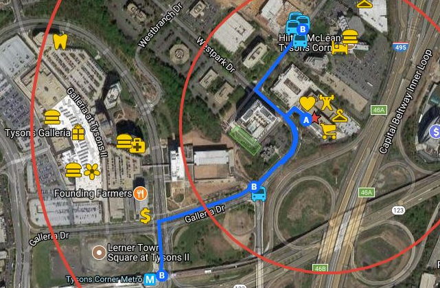
When starting off a LEED project, Google’s MyMaps is a helpful tool for determining and documenting many of the Sustainable Sites credits. For our LEED Gold Headquarters, we used MyMaps to determine that we could attain Development Density and Community Connectivity, SSc2, and Alternative Transportation – Public Transportation Access, SSc3.1, and its exemplary point.
The first step is to set the project location and the 0.5 mile and 1 mile radius circles. FreeMapTools (freemaptools.com) will draw a circle at a specific radius around a point that you can export as a Google Earth KML file and then import into your Google Map.
For SSc2, we searched the various list of terms, marking each location type with a symbol.
For SSc3.1, we searched for bus stops and then collected route information for those stops. Our local community bus stops didn’t show up in the search, so we actually had to walk around and find them and mark them on the map using the mobile application on a smart phone. Once we marked the bus stops, we added a walking route on the map to identify the distance.
View the final product here.
Comments